


OldSF
If you've ever wondered what it'd feel like to travel back in time and walk the streets of San Francisco, this might be the closest you'll get.
Two developers, Dan Vanderkam and Raven Keller, had the brilliant idea to take all the old photographs from the San Francisco Historical Photograph Collection and put them on an interactive map. This map functions similarly to Google Street View, except for when you zoom in on a particular place it gives you photos from as far back as 1850.
The project, called OldSF, lets you manipulate a slider to change the range of years (it goes from 1850 all the way up to 2000). The pair have geocoded about 13,000 images.
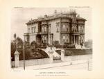
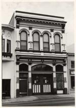
Visit the site here, or look below for some of the best photos we saw from the 1800s, marked with their locations in the city.
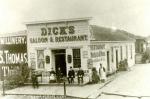
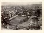
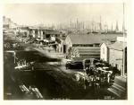
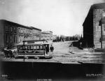
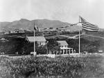
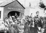
Point Lobos Avenue and 43rd, Dick's Saloon, 1890SAN FRANCISCO HISTORY CENTER, SAN FRANCISCO PUBLIC LIBRARYCentral Park, 8th and Mission, circa 1887SAN FRANCISCO HISTORY CENTER, SAN FRANCISCO PUBLIC LIBRARY
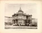
Group of people overlooking the Cliff House from Sutro Heights, 1890SAN FRANCISCO HISTORY CENTER, SAN FRANCISCO PUBLIC LIBRARY
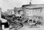
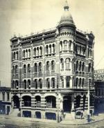
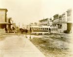
Bush Street, west of Kearny, 1877SAN FRANCISCO HISTORY CENTER, SAN FRANCISCO PUBLIC LIBRARY
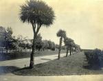
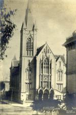
Palm Avenue in Jefferson Square, 1881SAN FRANCISCO HISTORY CENTER, SAN FRANCISCO PUBLIC LIBRARY
See the rest of the story at Business Insider
See Also:
- What it's really like to work at Google, the best company to work for in the US
- 21 photos of the most impressive free food at Google
- Netscape's billionaire cofounder Jim Clark is selling his Florida mansion for a whopping $137 million
SEE ALSO: 13 incredible photos you won't believe were found on Google Street View
